
You’ve submitted your application for a land survey, paid the fees, and now you are waiting. And waiting. Meanwhile, your property sale, bank loan, or family partition is completely paralyzed until that official 11E or Phodi sketch is in your hands.
Here is the hard truth: government systems don’t notify you when your file gets stuck on a desk. If you don’t actively track your Mojini V3 allotment status, your application could sit in digital limbo for months.
Many landowners confuse the general application status with the allotment status. They are not the same. Allotment is the critical bottleneck where a specific human being—a Licensed Surveyor (LSR) or Government Surveyor (GSR)—is legally assigned to visit your exact coordinates.
In this guide, I will show you exactly how to check your surveyor allotment status on the updated Karnataka portal, what the bureaucratic terms actually mean, and the exact steps to take if your file is stuck.
What Is Mojini V3 Allotment Status?
Government-assigned land — land granted for agriculture, housing, or rehabilitation — goes through an official allocation process. Allotment status shows exactly where that specific process stands.
Think of it like this: if a regular land survey is you asking “what are my land’s boundaries?”, allotment status is you asking “has the government officially confirmed this land is mine?” Two very different questions, both answered on the same Mojini V3 portal.
This service matters most if you’re a beneficiary of a government land grant, or a buyer trying to verify that a plot’s allotment was properly completed before you commit to a purchase.
| Service | Purpose |
|---|---|
| Allotment Status | Track land grant application progress. |
| Application Number | Unique ID for checking status. |
| Survey Number | Identifies specific land parcels. |
How to Check Mojini Allotment Status (Step-by-Step)
- Visit the Official Portal
Open bhoomojini.karnataka.gov.in using a secure browser like Chrome or Firefox. - Find “Allotment Status”
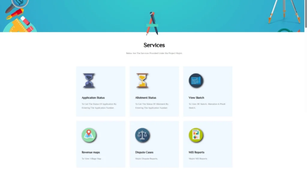
On the homepage, click on Allotment Status under the services menu (available in English or Kannada). - Select Search Method
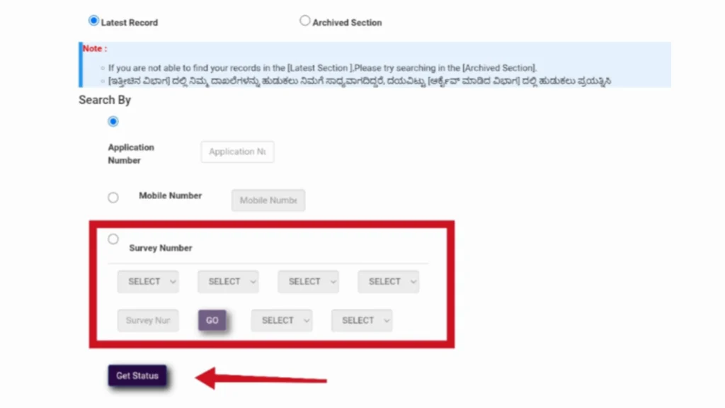
You can search in three ways:- Application Number – Enter the unique ID on your receipt.
- Mobile Number – Use the registered phone number.
- Survey Number – Select district, taluk, hobli, village, and enter survey/hissa numbers.
- Enter Details
Fill in the required details carefully to avoid mistakes. - Click “Get Status”
The system will show your application progress (Pending, Processing, Approved, Rejected). - Review and Download
Check your status and download any related documents if available.
📌 Note: No login is needed for basic status checks, but some services may require registration. If you face issues, re-check your details or contact support.
Understanding What Your Allotment Status Means
Not sure what the label on your screen actually means? Here’s the quick reference:
- Pending Verification — Your allotment request is in the queue and hasn’t been reviewed yet
- Under Process — Officials are actively verifying eligibility and land records
- Approved / Confirmed — Your allotment has been officially confirmed in government records
- Rejected — The allotment wasn’t approved; check the stated reason and follow up on next steps
- Ready for Print / Issued — Your allotment document is finalized and available
If your status stays unchanged for several weeks, don’t just keep checking that’s your cue to follow up directly (more on that below).
FAQs: Frequently Asked Questions
No, a basic check works without login using your application number, mobile number, or survey details. Logging in gives you a more detailed dashboard view.
Yes, checking your allotment status online is completely free.
If the land you’re buying was originally government-allotted, checking its status confirms the allocation was properly completed — protecting you from future ownership disputes.
Once the mojini v3 allotment status changes to “Assigned to Surveyor,” the professional handling your file will contact you to schedule a physical field visit to formally measure the boundaries of your land.