Mojini V3 is the latest update of Karnataka’s digital land records portal. With Mojini, you can check land sketches. These are simple boundary maps of a property. Think of them like a clear drawing that shows where your land starts and where it ends.
You can use all these services online. There is also a mobile app. So you don’t always need to visit a government office.
🔥 Important Posts 🔥
What is Mojini v3?
The Karnataka government has launched Mojini V3. It’s the new version of the land survey system. You can use it on the official Bhoomi Mojini portal.
Earlier, most land survey work was paper-based. Files, maps, old records. It took time. Sometimes, it was hard to track. Now things are different.With Mojini V3, land surveys are scanned and uploaded online.
So you can check them anytime. No need to depend only on physical copies. If you live in a village, this helps a lot. You don’t have to travel far just to see your land details. You can check them from home.
Mojini V3 Overview
| Platform | Karnataka Govt’s digital land survey & record system under SSLR |
| Core Purpose | Helps people check land records, view sketches, and prevent disputes |
| Access | Available via web portal (bhoomojini.karnataka.gov.in) & mobile app |
| Languages | English & Kannada |
| Services Available | Application Status, Allotment Status, View Sketch, Revenue Maps, Dispute Reports, MIS Reports |
| Official Website | https://bhoomojini.karnataka.gov.in/ |
- 🔥 Important Posts 🔥
- What is Mojini v3?
- Mojini V3 Overview
- Essential Features of Mojini App
- How to Register in Mojini v3?
- How to Log In to Mojini V3?
- How to Check Mojini Allotment Details?
- How to Track Mojini Application Status?
- How to Use Mojini v3 GSR Services?
- How to view the 11E sketch, alienation, and phodi sketch?
- How to View the Village Map?
- How to Apply for Survey Documents?
- What Reports are Available on Mojini v3?
- How to Download and Use Mojini App
- Contact Information and Support
- Common Questions about Mojini v3
Essential Features of Mojini App
The Mojini app has several features that make it easy to manage land records:
1. Application Tracking System
Users can track all information related to their land applications through the system. This feature lets users see updates on their application status in real time. It helps landowners stay updated on their requests.
2. Land Sketch Access
It provides a land sketch of various types of land.
- 11E Sketch: Shows the boundary of a specific land plot in detail.
- Alienation Sketch: Displays private individuals who have received government land.
- Phodi Sketch: Shows land boundaries for individual persons with the same survey number.
3. Revenue Maps
Users can access and view village maps through the platform. This helps in understanding the geographical layout of their area and neighboring properties.
4. Dispute Reports
The system gives users access to land dispute reports and management info. This helps them understand ongoing issues with their property.
5. Policy Updates
It offers the latest updates on land policies. This helps users stay informed about any changes that could impact their land rights.
How to Register in Mojini v3?
New users must register on Mojini v3 to get full access to services. The process is free and takes only a few minutes online.
To start, visit the official site — https://bhoomojini.karnataka.gov.in. On the home page, select the “New User Registration” option. You must provide a valid mobile number and email ID.
Steps for registration:
- Open the website on your browser.
- Click on New User Registration.
- Enter your name, mobile number, and email ID.
- Create a strong password.
- Verify the account with the OTP sent to your phone.
- Submit the form to complete registration.
After registration, users get a username for future logins. If there are any problems, help is available at the local revenue office.
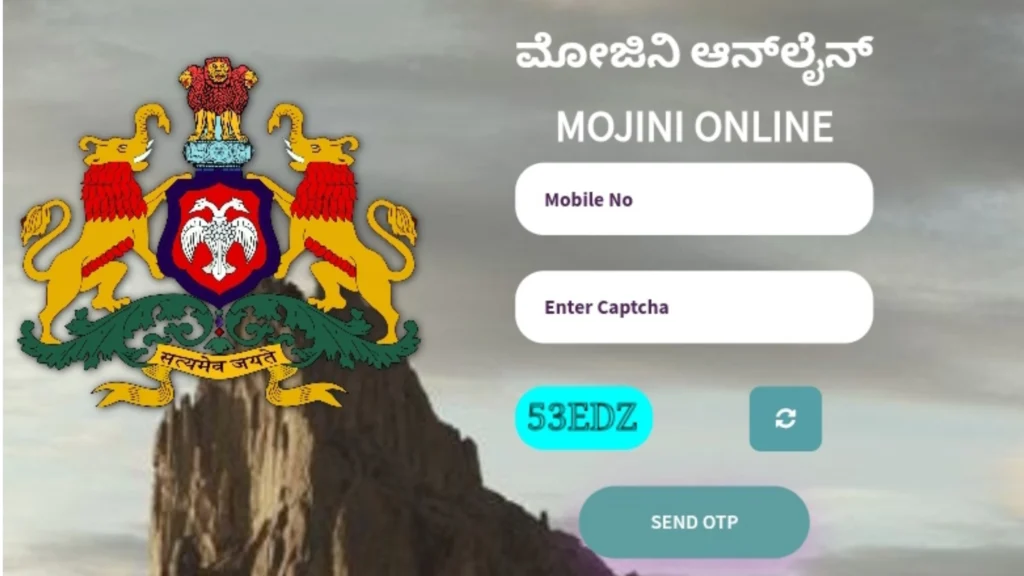
How to Log In to Mojini V3?
To access Mojini V3, you must log in through various portals. Users can log in using various official channels. This depends on their needs.

For standard Mojini V3 login, follow these steps:
- Visit the official website at https://218.248.32.25/v3_nop_new
- Enter your registered username and password.
- Click on the login button to access services.
For LSR (Land Survey Records) login:
- Go to https://bhoomojini.karnataka.gov.in/mojini/lsr.
- Input your registered username.
- Complete the CAPTCHA verification.
- Click “Validate Captcha” to proceed.
The GSR (Government Survey Records) login process is easy:
- Go to https://bhoomojini.karnataka.gov.in/MOJINI/GSR.
- Enter your username.
- Complete the CAPTCHA (refresh if needed).
- Click the validation button.
New visitors need to create an account to log in. If you forgot your password, click “Forgot Password.” Then, reset it using the OTP sent to your registered mobile number.
Need help logging in? You can call 08022221038 or send an email to sslrmojini.pmu@gmail.com.
⚠️ Tip: Always log out after use for security 🔒
How to Check Mojini Allotment Details?
The Mojini v3 portal allows users to check allotment details of land. These records show how the government distributed land, including grants given to individuals. Buyers also use the service to verify ownership before transactions.
Steps to check allotment details:
- Log in to your Mojini v3 account.
- Open the Allotment Details section.
- Enter the survey number or application ID.
- Select your district and taluk.
- Click Search to view the results.
The screen displays the information, and users can download it if required.
The SSLR v3 system connects to this feature. It ensures accurate data and helps stop illegal land claims.
How to Track Mojini Application Status?
Citizens using Mojini v3 can track the status of their land-related applications online. This service keeps applicants updated on survey and sketch requests. They don’t need to go to government offices anymore.
Users can search with their application number, mobile number, or survey number. The portal then shows the current stage — such as Pending, Under Review, or Approved.

Steps to check application status:
- Open the Mojini V3 home page.
- Scroll to the Application Status option.
- Select a search method (for example, application number).
- Enter the required details.
- Click Check Status to see results.
The results appear without delay. If users experience delays with applications, they can contact the helpline for support.
⏳ Stages: Pending ➝ Under Review ➝ Approved
How to Use Mojini v3 GSR Services?
Users can use GSR to check stamp duty values and move forward with property registration. Mojini doesn’t see it as a core part, but the service helps with legal transactions.
Steps to use Mojini v3 GSR services:
- Log in to the Mojini v3 portal.
- Open the GSR Services section.
- Enter the required property details.
- View stamp duty values or proceed with registration.
How to view the 11E sketch, alienation, and phodi sketch?
- Open any browser on your phone or computer.
- Go to https://bhoomojini.karnataka.gov.in/
- Scroll down on the home page. Find the “View Sketch” option and click on it.
- You will reach the Sketch Report View page.
- Enter your application number in the box given.

Click the Sketch View button to show your document on the screen. These documents serve specific purposes:
- 11E Sketch: Shows the precise boundaries and extent of your land parcel.
- Alienation Sketch: Displays government land assigned to private individuals or entities.
- Phodi Sketch: Illustrates land boundaries within village maps.
The mojini v3 sketch view is one of the best features of this land records platform.
How to View the Village Map?
Mojini V3’s Revenue Maps feature makes it easy for users to view village maps. This lets them view the land and see the property lines with clarity. This service offers detailed geographic information. It helps users see land layouts in villages with greater clarity.

To view a village map in Mojini V3, follow these straightforward steps:
- Visit the official website: https://bhoomojini.karnataka.gov.in.
- On the homepage, click on the Revenue Map option.
- Choose your district, taluk, hobli, and village from the dropdown menus.
- If the map does not appear, use the search bar to enter the village name or code.
- Once the map loads, view it on the screen or click the PDF icon to download.
💡 If the sketch/map doesn’t load, try clearing your browser cache or use another browser.
How to Apply for Survey Documents?
You can get your survey documents online. Use the Mojini V3 portal. It is simple and quick.

- Open any browser on your phone or computer. Go to this link: https://bhoomojini.karnataka.gov.in/. Scroll down on the home page. Find the option “Request for Survey Documents.” Click on it.
- Enter your mobile number in the box. Complete the captcha on your screen. Click “Send OTP.” You will get an OTP on your mobile. Enter that OTP. Now you are logged in.
- Click “New Request” on your dashboard. Select your district, taluk, hobli, and village from the dropdown menus. Enter your survey number, Surnoc, and Hissa number. Click the “Search” button.
- The portal shows all land documents for that survey number. Click the eye icon to view a document. Click the printer icon to print it. You pay ₹15 per document to get an official copy.
- Don’t worry. Scroll to the bottom of the page. Look for “Need a document not available above?” Click on it. Enter the applicant’s name. Choose the document type. Then click “Create Request.”
💡 For long delays, contact the helpline: 080-22221038 or email sslrmojini.pmu@gmail.com.
What Reports are Available on Mojini v3?
The Mojini v3 portal provides several reports related to land records in Karnataka. These reports provide official data from the SSLR v3 system. They are helpful for citizens and government officials.

Users often download reports for personal reference. They may use them for property checks or even in court cases.
Steps to access Mojini reports:
- Log in to your Mojini v3 account.
- Open the Reports section.
- Select the type of report (for example, Dispute Report).
- Enter details such as village name or survey number.
- Generate and download the report.
Common report types include:
| Report Type | Purpose |
|---|---|
| Dispute Report | Lists ongoing land conflicts and their resolutions. |
| Management Info | Shows statistics on land use and completed surveys. |
| Allotment Summary | Gives details of government land grants. |
The team updates these reports on the portal at regular intervals. This way, users always get the latest version.
How to Download and Use Mojini App
The Mojini app is available for both Android and iOS users:
Download Process
- Open Google Play Store (Android) or App Store (iOS).
- Search for “Mojini” in the search bar.
- Click on the official Mojini app by Karnataka Government.
- Tap the install button.
- Wait for the download and installation to complete.
Using the App
Mojini is easy to use. It’s made for everyday people. Now, anyone can access land services and important documents online with minimal effort. The Revenue Department of Karnataka runs this app.
The app interface is in Kannada and English. This makes it easy for users who prefer either language.
Contact Information and Support
If you’re facing issues with mojini v3, there are several ways to get fast help. For help with mojini v3 login issues, you can reach the main support line at 08022221038. For technical support, users can also email sslrmojini.pmu@gmail.com.
Karnataka residents can contact division-specific help desk numbers based on their location:
| Division | Help Desk Contact Number |
|---|---|
| Mysore Division | +91 8277 864065 |
| Bangalore Division | +91 8277 864067 |
| Kalaburagi Division | +91 8277 864068 |
| Belagavi Division | +91 8277 864086 |
These regional help desks operate from 10:00 AM to 6:00 PM daily. If you can’t log in or need help with your mojini app, contact these support channels first.
Common Questions about Mojini v3
The Mojini v3 portal may stop working at times due to server issues, browser errors, or wrong details entered by users. To fix this, clear your cache, check your internet, or try again later. If the problem continues, contact sslrmojini.pmu@gmail.com or call 080-22221038.
Visit bhoomojini.karnataka.gov.in. Enter your username, password, and CAPTCHA, then click Login. New users should register first by choosing Citizen Registration. If you forget your password, reset it with an OTP sent to your mobile.
Go to bhoomojini.karnataka.gov.in and click on Application Status. Enter your application number, mobile number, or survey details. Press Get Status to see updates. Check weekly for real-time progress.
Open bhoomojini.karnataka.gov.in and go to Application Status. Enter your application or survey number. You can view your Podi status online and download the Phodi sketch if it is approved.
To use the service on mobile, search for “Mojini” in the Google Play Store or Apple App Store. Then, install the official app. After downloading, log in with your details or register if you are a new user. Direct links are also available on bhoomojini.karnataka.gov.in.
Visit landrecords.karnataka.gov.in and click on View RTC and MR. Enter the landowner’s name along with district, taluk, hobli, and village details. Then click Fetch Details to view and download the RTC Bhoomi record.